 |
 |
 |
 |
 |
 |
| LONDON TO BRIGHTON 2009 |
|
|
|
|
|
|
 |
 |
 |
 |
 |
 |
|
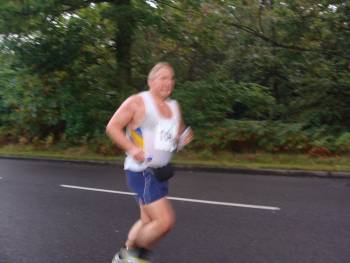
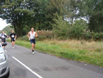
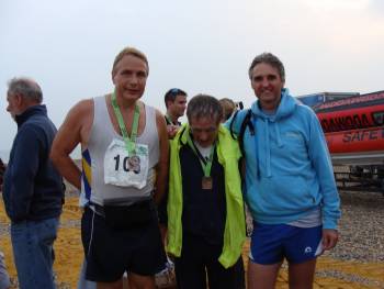
Jim
Fitzmaurice, Paul Tabor and I took part in the London to Brighton
- a 56 mile (90 kilometer) ultra running event last Sunday
(20 September). We started from Blackheath in London, at 6am, and ran on trails through the English countryside of
Kent, Surrey and Sussex to Brighton, writes Rob
Carr.
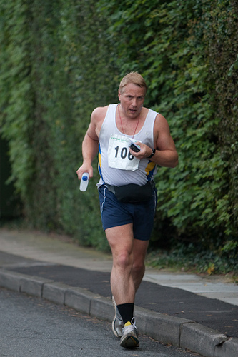
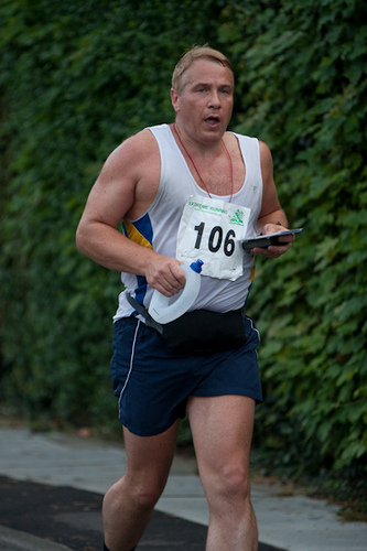
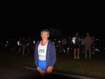
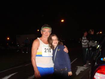
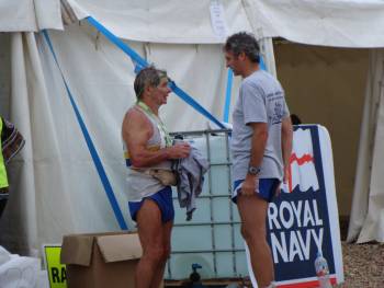
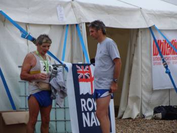
As if running 90kms isn't challenging enough we had to navigate our way armed with a map and compass. We had to reach 4 checkpoints along the way within a certain time or be disqualified. We also needed to be self-sufficient so had to carry water, food, change of clothes, money, phone etc... It sounds insane! So why do this? Apart from the physical and mental challenge, I ran this in memory of my friend Carl Pauls who died tragically in a car accident on 2 September 2009. I finished in 11h47 (official time: 11:49:27). Jim’s time was 12:21:03 and Paul's 12:37:15. Full details and results HERE. The run itself was extremely tough – much tougher than I expected. I was doing pretty well until 30 miles which I reached in just under 5 hours, so with “only” 26 miles to go I felt 10 hours was achievable. Unfortunately a combination of things slowed me down: 1) Pure fatigue 2) Going off course. I went off course at least 4 times. My lowest point in the whole race was at about 32 miles into run. I was on the side of a huge field and couldn’t see anyone ahead of or behind me. I had my map but the marked route was taking us over a freshly ploughed field. Surely this couldn’t be right… I started to doubt my map reading skills and felt completely lost. I could have burst into tears at this stage. Anyway I started to run back the way I had come. Fortunately about 5 minutes later I came across a group of runners. One of the guys knew the course well. It turns out I was on the right but instead of running across it we ran around the field to get to the other side. I was frustrated (to have lost the time) but glad to have some company, especially someone who knew where he was going… 3) Having met this guy (Martin), although he was running slower than I wanted to be it seemed to make sense to run with him. As I didn’t feel the need for a map I put it in the side pocket of my back pack. Later on I realised my map had fallen out my bag. I couldn’t afford to go back and look for it and risk losing my “guide” so I stayed with the group. By this stage Martin was walking a lot. I just wanted to get the whole thing over with so wanted to go as fast as my body would take me. Fortunately at the 46 mile check point I managed to get a photocopy of the map. This allowed me to run ahead of the group. Problem was the map soon became soggy with sweat and it was hard to read - but I managed. Besides I was regularly catching up with a few walkers so never went off course from this point – thank goodness because I don’t know if I could have coped with it at that stage! 4) I fell over three times. I mustn’t have been lifting my left leg enough and stubbed my left toes (the same spot each time) on rocks/tree roots and fell over. Strangely each time my right calf seized up. Nothing too serious in the greater scheme of things as the calf relaxed quite quickly but it I was convinced I had broken my toe. One funny thing on the third time I fell out of pure frustration and pain relief I started swearing – but in Afrikaans. Turns out there was a South African guy not far behind me so we chatted for a few minutes. 5) The big hill at about 48 miles (see below) – it’s called Black Cap and was practically a never ending vertical climb. 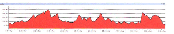 The main thing is I finished. Apart from all the cuts, bruises and chafing I felt pretty good the next morning. Without going in to too much detail I was thankful for having nappy rash cream in the house! I’m not sure if it was just adrenalin but my legs felt absolutely fine – in fact I planned to go for a recovery run later! I know I am mad – but I don’t think I’m mad enough to run the London to Brighton again! Paul Tabor adds: Having just got back from holiday on the previous evening, I was very grateful to Rob and Julie Carr who took a detour to collect me from home on their way to the start. I started running with Rob, but found the pace a bit too fast after a couple of miles, and dropped back. I reached the first checkpoint at 9.5 miles in 1 hour 20 minutes and the second at 18.5 miles about 2 hours later. I had a scare at the 3rd checkpoint. I had thought it was 27.5 miles with a 6 hour cut-off, and arrived there with 5 minutes to spare to be told that Id run 30.5 miles and the cut-off was 45 minutes later than I thought. This meant that the next checkpoint was easily reached well within the allotted 8½ hours, and the organisers told us at that point that we had done all the hard work and were certain to finish. I think that may have been a little over-optimistic. In such a long run, there are always up and down points. Mostly we ran on the flat and down-hills and walked the uphill sections. My low point was at around 8½ hours where I found I could only walk even on the flat across some rough ground. I was convinced at that time that I would make it to the last checkpoint on time, but that I would complete outside the overall 13 hour limit. An hour or so later, though, I had a burst of energy and was bounding along as I headed for Black Cap at around mile 50. I found the climb of just over 200 metres up Black Cap (210 Metres) relatively easy, but I had lost some of my early energy and set off from the top for the final 6 miles a little slower. I ran the last couple of miles with someone I had seen at various points on the route. It helped to have someone to run with at that point, and we were welcomed at the finish by Rob and Jim when we finished in 12 hours 38 minutes (TBC). It was good to see the same faces regularly along the route, encouraging us as we ran. The checkpoints were well-located and stocked with copious amounts of water and food, including the most delicious orange pieces. A major aspect of the run was the navigation, and the route wasnt marked out except in one or two places where it crossed private land or where last-minute changes had been made. This made it hard in places, because the map scale was necessarily small and a few arrows would have been useful in particularly difficult spots. Somehow, I was lucky with every decision I made about the route and lost very little time as a result. There were a few problems at registration and the finish. Also, the satellite tracker device we paid for was a great disappointment. It was far too large to go into my waist belt, and I found out after the race that it hadnt even worked. However, in other respects the race went very smoothly. Not having tackled anything like this for many years, I had been rather daunted by the distance, but at least this ensured that I didnt skimp on the training beforehand. Apart from the organisers and helpers, Im particularly grateful to Rob and Julie for going out of their way to take me to and from the race. Also to Heather who gave her encouragement on the course, and offered me a sports drink; and to Irene Fitzmaurice for taking photographs. And Jim Fitzmaurice adds: I have recovered very quickly, the run was good I felt great all through the day my support team was fantastic and helped me to have agreat day: a big thank you to everyone. However I went off route more than once: first in Downe, a route I know very well, then at Lower Burrells, a place I also know and where I had my energy drink hidden by the railway bridge. Then as I was heading down to the finish from Drove road,I took the Jog Shop 20 route instead of going to the golf course. That put a lot of extra miles on for me, but I wouldn't have missed it for the world. |